



Mount Raung Eruption, Public Urged to Avoid Activities within a 3-Kilometer Radius
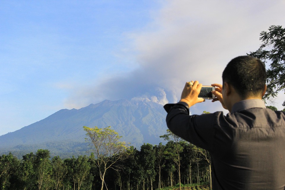
Jakarta. Muhammad Wafid, Head of the Geological Agency of the Ministry of Energy and Mineral Resources (ESDM), urged the public to avoid activities within a three-kilometer radius from the summit or crater of Mount Raung, following an increase in the volcano's activity, which is currently at the disaster alert level 2.
"On December 24, at 09:30 WIB, Mount Raung erupted, producing an eruption column about 2,000 meters above the summit, which is 5,332 meters above sea level. The eruption column appeared gray with thick intensity, leaning eastward," he said.
The eruption was recorded on the seismograph with a maximum amplitude of 32 mm and lasted about 4 minutes and 42 seconds. Further visual observation of the eruption column could not be made because the summit and body of the mountain were covered in mist. Four subsequent eruptions occurred between 10:25 a.m. and 12:10 p.m. with maximum amplitudes ranging from 13 to 23 mm and durations ranging from 1 minute 54 seconds to 3 minutes 25 seconds.
According to Wafid, although this eruption activity is considered normal, the fluctuating pattern of the volcano’s activity means that another eruption could occur at any time. Currently, impacts from the latest eruption are limited to the area around the crater or summit, with the expulsion of materials like incandescent rocks, while volcanic ash rain may occur depending on wind direction and speed.
"At this point, there has been no significant change in the danger threat of Mount Raung," he said.
Wafid emphasized the importance of the public adhering to the recommendations of the Geological Agency and avoiding inaccurate information about Mount Raung’s activity. The Geological Agency is also in continuous coordination with related agencies such as the National Disaster Mitigation Agency (BNPB), the Meteorology, Climatology, and Geophysics Agency (BMKG), regional governments, and other institutions to monitor the eruption's development.
"The Geological Agency continues to coordinate with BNPB, BMKG, relevant ministries and agencies, local governments, and other institutions regarding the eruption activity of Mount Raung," he concluded.
Tags: Keywords: as a preferred
Related Articles

KPK Names Disaster Agency Chief's Brother in Corruption Probe
KPK names five suspects, including BNPB chief Suharyanto's brother, in an alleged disaster relief corruption case.
KPK Detains 14, Seizes Cash and Gold in Disaster Agency Corruption Probe
KPK detains 14 people, including a senior BNPB official, and seizes Rp 1.4 billion in cash and gold in a corruption probe.
Mount Anak Krakatau Erupts Three Times Tuesday Morning
Mount Anak Krakatau erupted three times Tuesday morning, prompting authorities to bar activities within 3 kilometers of its active crater.
Japan’s Fire Aid Helicopters to Arrive in Indonesia This Week
Japan will send three CH-47 Chinook helicopters to Indonesia's fire aid.
Indonesia Has 735 Hectares of Peatland Fires Still Burning, BNPB Says
About 735 hectares of peatland remain on fire in six Indonesian provinces, with authorities warning that fires can reignite underground.
Indonesia Uses Weather Modification to Clear Volcanic Ash From Anak Krakatau
Indonesia launches a weather modification operation to reduce volcanic ash from Mount Anak Krakatau affecting Java and Sumatra.
Indonesia Wildfires: Govt Prepares Additional Disaster Funds
Indonesia says it is ready to provide additional funding for the Kalimantan forest fire response.
Eastern Indonesia Earthquake Death Toll Rises to 105
The death toll from a powerful earthquake in Indonesia’s East Nusa Tenggara province has risen to 105, with 179,037 people displaced.
Indonesia Deploys 52 Aircraft to Battle Forest Fires Across Six Provinces
Indonesia deploys five more Air Force aircraft to Kalimantan, bringing the wildfire response fleet to 52 aircraft across six provinces.
NTT Earthquake Death Toll Rises to 71
Indonesia’s NTT earthquake death toll rises to 71 as more than 3,000 aftershocks rattle the region.The Latest

Chandra Asri Group Receives Trade Finance Excellence Award, Reinforcing Its Role in Indonesia’s Industrial Development
Chandra Asri Group receives the Trade Finance Excellence Award at CIMB Niaga Business Summit 2026.
AEON MALL Deltamas Brings 11 Sports and Creative Competitions to AEONLYMPIC 2026
AEON MALL Deltamas hosts AEONLYMPIC 2026, featuring 11 sports and creative competitions, with more than 3,100 participants.
Indonesian Stocks Extend Losses for Third Day, Fall 3.64% to 4,996
Indonesian stocks fell 3.64% on Monday, extending losses for a third straight session amid MSCI concerns and tighter trading limits.
Prabowo Calls Meeting on Forest Fires as Haze Reaches Jakarta, Singapore
Prabowo summons senior officials to discuss forest fires as smoke reaches Jakarta and Malaysia pushes for regional action.
Jakarta Outranks Amsterdam in Global Public Transport Survey
Jakarta climbs two places to 15th in Time Out's 2026 public transport survey, with its governor citing better network integration.Most Popular
